Setting-out

Boundary setting-out in Varna

We set out land plot boundaries in Varna and the region: we locate the cadastral map points on site and mark them, so you know exactly where your property ends.

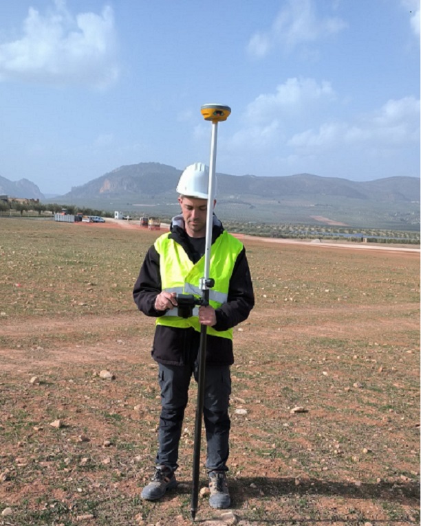
Surveyor with a GPS receiver setting out points on site

What boundary setting-out is

Setting-out is the reverse of surveying. We take the coordinates of the plot's boundary points from the cadastral map and find them on the ground with GPS or a total station. Each point is marked with a stake.

You don't need to prepare stakes: we bring our own, 40 cm tall and marked with red spray paint. The boundary is then easy to see and can be used for a fence, a building or a conversation with your neighbour.

When you need it

  • You are building a fence and want it exactly on the boundary.
  • You suspect your neighbour has encroached on your plot, or the other way round.
  • You are buying a plot and want to see on site exactly what you are buying.
  • You are starting construction and need to know where the regulation or building line runs (see construction surveying).
  • The old boundary markers have disappeared.

Documents required

  • proof of ownership;
  • a sketch of the property.

If you don't have a sketch, we can tell you how to order one or obtain it as part of the service.

What you receive

  • boundary points marked on site;
  • an on-site explanation of which point is where and how the boundary runs;
  • if the fence and the cadastral map differ: clear information about the difference and your options, including a cadastral map amendment project.

How to prepare

Send us a copy of the proof of ownership and the sketch in advance, so we can check the coordinates before the visit. If the plot is overgrown, clear access to its corners as far as possible. If you suspect a dispute with a neighbour, it is a good idea to notify them and have them present: the boundary is then shown to both sides at once and misunderstandings are avoided.

How the work proceeds

  1. Enquiry

    You send us the address or identifier of the property and the documents you have.

  2. Preparation

    We take the coordinates of the boundary points from the cadastral map.

  3. Setting-out on site

    We find the points with GPS or a total station and mark them with stakes.

  4. Explanation

    We show you the boundary on site and answer your questions.

Timeframe

The timeframe depends on the size and complexity of the task and on your specific requirements. We will give you a timeframe together with our quote. The time the relevant institution needs to review the documents comes on top of that.

Frequently asked questions

You need proof of ownership and a cadastral sketch. You don't need to prepare stakes: we bring our own, 40 cm tall and marked with red spray paint.

We recommend that you or someone you trust is present, so we can show you the points on site. That way you will know exactly where the boundary runs.

We show you how big the difference is. If it is due to an error in the map, it can be corrected with an amendment project. If there is an ownership dispute, the decision lies with the court.

The timeframe depends on the size and complexity of the task and on your specific requirements. We will give you a timeframe together with our quote. The time the relevant institution needs to review the documents comes on top of that.

Need a licensed land surveyor in Varna?

Raychev & Co.

Raychev & Co.

Write to us now

We will reply as soon as possible

Raychev & Co.
Hello 👋
Start a chat:
chat