Surveys

Topographic surveys

We produce topographic surveys of properties and sites in Varna and the region: an accurate basis for design, detailed development plans, design visas and construction.

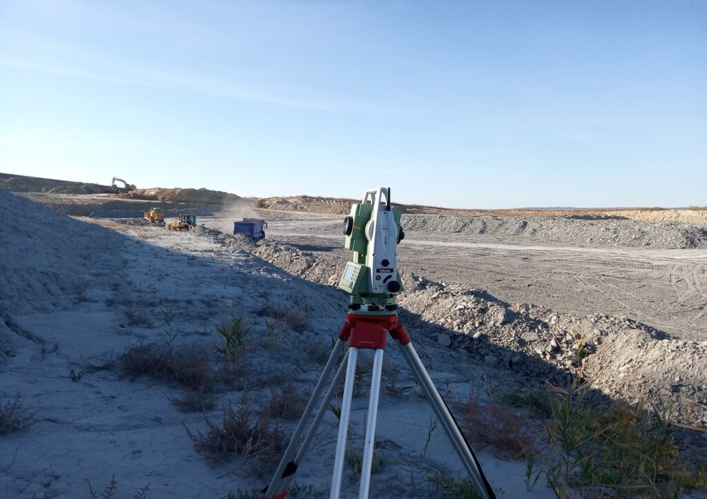
Total station on a tripod during a topographic survey

What a topographic survey is

A topographic survey is an accurate measurement of the terrain and everything on it: boundaries, buildings, fences, trees, roads, manholes and ground levels. The result is a drawing with coordinates and spot heights on which the architect and engineers base their design.

In Bulgarian it is also called a tachymetric survey, after the instrument used: a tachymeter or total station. For large sites we also use drone photogrammetry.

When you need it

  • For an investment project: the first step, before the architect starts.
  • For preparing or amending a detailed development plan (PUP).
  • For a design visa and a grading plan.
  • Before buying land, so you know the slope, the access and the neighbouring buildings.
  • For legalising an existing building.

What the survey contains

  • boundaries of the plot and the neighbouring plots according to the cadastral map;
  • buildings, fences, roads and pavements;
  • trees, manholes, poles and visible utilities;
  • spot heights and contour lines of the terrain.

We deliver it in DWG and PDF, and on paper, organised in folders.

Documents required

  • proof of ownership;
  • a sketch of the property;
  • a design visa, if you already have one.

Accuracy and coordinate system

The survey is produced in the coordinate system of the cadastral map (BGS2005) and the national height system. That way the architect, structural engineer and utility engineers all work from the same data, and the building can later be set out on site without discrepancies.

The size and complexity of the site determine the method: for gardens we use a total station and GPS, and for large or hard-to-reach sites we add a drone.

Common mistakes when designing without a survey

  • the building ends up closer to the boundary than the visa allows;
  • the ground floor level is below street level and water runs towards the building;
  • a tree, pole or manhole that gets in the way of construction was not taken into account.

How the work proceeds

  1. Enquiry

    You tell us what the survey is for: a design, a development plan, a design visa or construction.

  2. On-site measurement

    We survey the property with a total station, GPS or a drone.

  3. Processing

    We draw up the survey with coordinates, spot heights and contour lines.

  4. Delivery

    We deliver the survey to you or directly to your architect.

Timeframe

The timeframe depends on the size and complexity of the task and on your specific requirements. We will give you a timeframe together with our quote. The time the relevant institution needs to review the documents comes on top of that.

Frequently asked questions

In practice the two terms mean the same thing: measuring the terrain and the objects on it with coordinates and heights.

Yes. The sketch shows only the boundaries and buildings. The survey also shows the relief, trees, utilities and everything else the designer needs to know.

The price of a survey depends on the size and complexity of the property and on the specific services requested. We will give you a detailed quote before any work begins.

The timeframe depends on the size and complexity of the task and on your specific requirements. We will give you a timeframe together with our quote. The time the relevant institution needs to review the documents comes on top of that.

Need a licensed land surveyor in Varna?

Raychev & Co.

Raychev & Co.

Write to us now

We will reply as soon as possible

Raychev & Co.
Hello 👋
Start a chat:
chat